Beaver Brook Falls – Keene, NH

DSC_0583DSC_0580

Overall Rating: 2/5
Swimming Not Allowed
Handicap Accessible – falls are on a paved road but there’s not much to see roadside

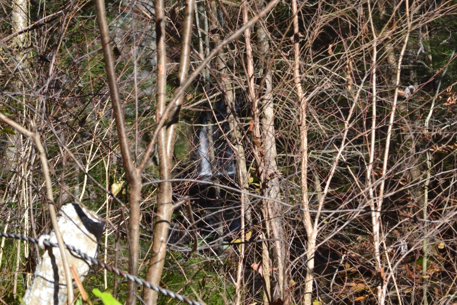
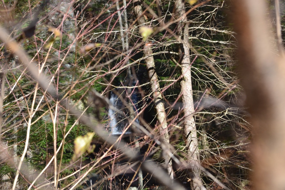
Beaver Brook Falls is an odd little place. It sits off an old paved road just outside of the central Keene area. The road is now closed to vehicular traffic, but you can still hike up to the falls and have a little adventure! I’d like to mention, if you’re like me and hunt waterfalls on-line a bit before going to see them, this is one that I’ve seen several pictures of where the area is completely clear and you can see straight to the falls from the road; pictures from both old postcards and from about ten – fifteen years ago now. The area has changed quite a bit and is not maintained as I assume it once was. You really have to try in order to see this waterfall from the roadside!

Although the main attraction here is the waterfall and trying to get down to it, there are a few other places along the way to see that would be quite nice for other ventures. Part of the brook on which the cascade can be found runs under the old road at the beginning of your walk. If we had known just how much of the waterfall we would view when we first visited this area, I think we would have stopped at this little bridge with a couple of chairs, a good book, and just sat, watched and listened to the babbling brook.
There are a couple of different rock ‘walls’ (for lack of a better term) on the left side of the road as you’re walking up to the falls, one of which features a side profile of what is supposed to be a man’s face. The profile can be viewed both walking to and from the falls. Unfortunately, at the moment I am unable to find the name or any other information online that tells you the name, however, by the entrance gate, there is a sign telling you the couple different attractions you’ll see on your walk.


DSC_0574
You can just barely make out the waterfall behind the trees.


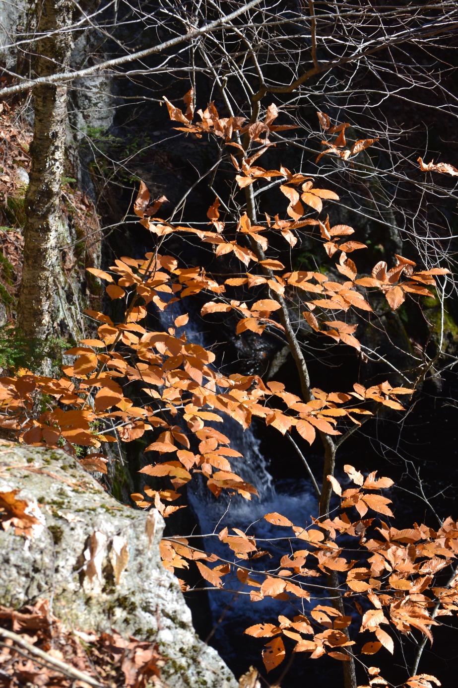
The falls themselves are only about a 12ft drop with three small tiers, but are still a pretty cool sight from above or below (below being per pictures I’ve seen… sorry, folks, I don’t have any personally.) The falls aren’t really complicated to find; you can hear and partially see them about .55 mi up the old road. However, if you’d like to see them straight-on, you would need to scramble down a hill a little bit. It’s best to do this downstream from the falls (not right at them) and with tons of bug and tick spray. Like previously mentioned, the area is covered in tall grass and since this season’s tick population is so terribly terrible, please take precautions!

Here are some other things you might see while visiting the area:


In order to find Beaver Brook Falls, follow NH Rt 9 into Keene. Turn onto Washington St, then in .25mi turn left onto Concord Rd, then another almost immediate left onto Washington St Ext. Keep going down the road to the yellow gate; park in front of the gate and hike up the road to the falls.

Have fun and be safe!!


Stonehouse Pond – Barrington, NH

IMG_7104

I never thought I would see something like this sitting in the middle of a town in southern NH, but it’s here and it’s got an amazing view! It’s a little steep to get up to the hill, but so well worth the climb. When you arrive at the top, you’ll see the pond below and in the distance, the Blue Hills of Strafford. And trees. Lots of trees.

While sitting atop the rocks, you can usually see duckies floating on the pond, sometimes a kayaker floating along as well. It’s very peaceful and relaxing, which helps after the steep upclimb. Unfortunately, no swimming is allowed here, but there is ‘Cartop Boat Access’, so you’re more than welcome to row, canoe or kayak the pond. The pond is managed as a ‘fly-fishing trout pond’, so fly-fishing is allowed, but only at certain dates. Please check the bulletin board when pulling into the parking lot for rules on fishing at this pond.

There are two access entries to this pond, but it really just ends up being a loop and depends on how steep you want your path up and back down to be.
The first entrance can be found at the parking area just below the pond. To the right of the bulletin board, follow the stream to the dam, where you’ll find a small branch-bridge. Cross this bridge and follow the footpath you’ll find. Unfortunately, the footpath isn’t marked so you’ll have to follow the trail as best you can. This path is very steep; please proceed with caution.
The other trail entrance is back a bit from the pond. As you’re coming down the road to the pond, you’ll find a widened area where there is room enough for four to six cars depending on how you park. On the right side of the road, there are orange markers. In the winter, this is a snowmobile trail, but you can follow it, all the same, to get to the rock face. This side of the trail is marked which, by my understanding, makes it easier to travel.

To find Stonehouse Pond, follow Route 202 into Barrington. It is located 1.9 miles from the Rt 202/Rt 9 junction in Rochester and 3 miles from the Rt 202/Rt 4 junction in Northwood. The entry is marked with a fish and game sign and can be found on the East side of the road.

Have fun and be safe!!

Pollard(s) Mills – Newport, NH

Overall Rating: 5/5
Swim Rating: 4/5
Hike Time/Distance: Negligible
Hike Difficulty: Easy
Fee: None, but donations are accepted and appreciated
Handicap Accessible // No Dogs Allowed

The height may not be as impressive as what you’ll find in the White Mountains, but the sound and current of the water are much more overwhelming, no matter what time of year you visit! Pollard (or Pollards, depending on who you ask) Mills sit off the beaten path in Newport, just a short ways away from Route 10 and Unity Rd, the main road through the town. It’s quiet, secluded and one of the best places to visit on a hot summer day!

This is an 18 foot waterfall with several different tiers, including some upstream that are slightly hidden. At the highest drop, there is a pretty cool pothole probably about 6-7 feet deep. I imagine, if you’re tall enough, that this would be a great pool to jump into to cool off! There are several places to dip your toes in and an awesome pool down the bottom, as well.

Pollards Mills, as you could probably guess, was once the home of not one, but three different mills: a lumber, a grist, and a peg mill. Where the last tier of the waterfall currently is used to be a dam; both the dam and the mill that sat with it was washed out in the early 1900’s. There are some spikes and rock walls along the side of the falls that show the remnants of the old mill.

This waterfall is technically on private property, but, at this time, the landowner has it open for public access, as long as you’re respectful. As you can tell from the signs in the pictures above, the landowner asks that the area is kept clean, no dogs are brought along, glass is kept off the property and alcohol is not brought on the premises. And, to be honest, except for the pup part, if you can’t enjoy a natural area without doing those things, then you don’t belong there in the first place. (It may be mean, but it’s very true!!!) For safety’s sake, please, please, please, don’t bring your pupper along! Don’t just disobey the signs – the rocks here are very steep, the current of the falls is very strong; it’s just too dangerous to risk your favorite friend’s life.
There is no trespassing after dark, and, not only to respect the landowners wishes and not get yourself arrested, but for safety reasons, it’s highly suggested you heed this rule.
One last sign you’ll see is a sign that says, ‘People drown without a sound’. As mentioned above (and as I keep repeating myself), it’s dangerous here and it’s asked that you swim at your own risk.

If you’re looking to visit here and need handicap access, everything is visible from the parking area! Speaking of parking, there is space for about 5 cars.
To find the falls, take Pollards Mills Rd from Unity Rd or Rt10 in Newport and follow it to Falls Rd. Turn onto Falls Rd, and the parking area will be on your left.

Have fun and (please, on this one especially) be safe!!

Beede Falls – Sandwich, NH

Overall Rating: 3/5
Swim Rating: 3/5
Hiking Distance/Time: .25mi / 5min
Hiking Difficulty: Easy
Fee: None

About half an hour from NH-16, tucked away in Sandwich Notch Park sits a neat place called Beede Falls. It’s not just another waterfall in the White Mountains; there’s a bit more to it than that! Not only will you find a main waterfall here flowing into a refreshing wading pool, you’ll also find a lower falls that doubles as a natural water slide (several for that matter!) Each tier is short enough, each along with a pool shallow enough to slide down into! The pool at the upper falls is shallow enough (only about knee/calf deep while regular flow) to stand under and behind the falls.

The water here, at least the few times we’ve been, is very chilling. However, I suspect this is due to the fact that there was no sun shining when we visited. It’s a wide enough open area for the sun to hit, so I can only imagine that this would be quite different on a warm and sunny day. Like I previously stated, it’s really only deep enough to wade in, however, I’ve seen astounding pictures when there’s is high water flow and it looks like you could really go for a deep swim! PLEASE, I BEG YOU, if you decide to make that crazy choice, be safe, be careful…. really just don’t be stupid. If you’re not a strong swimmer or the current looks intense, stay away! No thrill is worth your life.

Along with the falls, there’s a couple other things to check out at and around the area. There’s Cow Cave, for one. The story goes that a cow wandered off from a long ago nearby farm. It went missing for a good chunk of the winter and was later found hiding in the cave near the falls. I’m going to have to take another gander, but all the references I’m finding say the cave is the one just under the waterfall. However, I remember seeing a sign after the footbridge, just beyond the falls, that pointed towards the Mead Base Trail. If you know where the cave actually is, please inform me!
Ah, that’s another trail to take! The Mead Base Trail will lead you on a moderate hike back to the Mead Explorer Base Camp. If you decide to take this route, after arriving at Base Camp, the hike is about a half an hour back to the parking lot at the falls.
One last place to stop as you’re making your way back from Sandwich Notch Rd, is an overlook on Diamond Ledge Rd. There’s enough room on the east side of the road to pull over and take in the view of (I believe) Dinsmore Pond. It’s a breath taking view, as you can see from a couple of the pictures above, especially at sunset.

To find Beede Falls, take 109 or 113 to Diamond Ledge Rd. Instead of going straight to the Base Camp, take a left at Sandwich Notch Rd. Follow the road for about .9mi; the parking lot will be on your right.

Have fun and be safe!!

Diana’s Baths – Bartlett, NH

Overall Rating: 5/5
Swim Rating: 3/5
Hiking Distance/Time: .6mi / 25min
Hiking Difficulty: Easy
Fee: $3/car
Restrooms Available (Year Round) // Partially Handicap Accessible

If you visit Cathedral Ledge and Echo Lake in Bartlett, you should most definitely take a short trip up the road and visit Diana’s Baths! An easy walk through the woods will lead you to an astounding waterfall with many tiers. It’s beautiful in summer, in autumn, in winter – pretty much year round!

If you’ve ever wondered where the name comes from, here’s a bit about the name origin taken from Wikipedia:
These curious circular stone cavities on Lucy Brook originally were known as the Home of the Water Fairies; tradition says evil water sprites inhabited the ledges, tormenting the Sokokis Indians until a mountain god answered the Indians’ prayers and swept the sprites away in a flood. But sometime before 1859 a Miss Hubbard of Boston, a guest at the old Mount Washington House in North Conway, rechristened them Diana’s Baths, presumably to evoke images of the Roman nature goddess. The pools are also called Lucy’s Baths.

Diana’s Baths is a wonderful swimming hole in summer – it’s also extremely popular, so get there as early as you can!! There’s little wading pools all along the way, below each tier’s fall. I’ve heard that all the way at the top, there’s a pothole that you can swim in, but I have yet to see it. Hopefully this summer, though!

The walk is very simple and easy on the body. It’s also one of the best ones to go on with small children. It isn’t paved, but the walkway doesn’t have too many rocks or branches, so the trail, for the most part, is handicap accessible up to the lower falls. After that, it’s a bit tricky unless you have an ATV type wheelchair.

To find Diana’s Baths, take West Side Road into Bartlett. It will be on the east side of the road, but really, you can just follow the millions of signs you will surely see!!

Have fun and be safe!!

Screw Auger Falls – North Oxford, ME

(Not to be confused with Screw Auger Falls in Gulf Hagas, ME)

Overall Rating: 3/5
Swim Rating: 3/5
Hike Time / Distance: Negligible / Less than .1mi
Hike Difficulty: Easy
Fee: 3$/person for ME resident // 4$/person for non-resident // 1$/senior citizen (65 & older)
Restrooms Available // Partially Handicap Accessible (There is an access trail to see the upper falls)
A pdf with more information on Grafton Notch State Park and Mahoosic Public Lands can be found here.

Just a half mile up from Step Falls in Newry on Route 26 sits Screw Auger Falls. As you first walk in from the parking lot, you see the upper falls, which, in all honesty, can leave you slightly unimpressed. But, a short walk to the left will lead you to a pretty impressive gorge and an awesome natural arch. (Okay, so it’s a tiny little arch, but it’s not man made and I call that pretty awesome.)

I thought this waterfall was cute, but it honestly left me, overall, a bit unimpressed. I try to keep direct opinions off of here and just give overall summaries, but maybe it’ll help you along on your trip, so here goes. I don’t know if it was the fact that there wasn’t much to explore and see or the fact that you’re paying a bit too much for what you’re seeing, but something about this place left me kind of feeling… for lack of a better word, ‘meh’. The gorge was cool and the natural arch was probably my favorite, but other than that, I was bored. And, let’s be real, I don’t normally get bored at waterfalls. I looooove them (if you couldn’t already guess by most of my posts).

Don’t get me wrong, if you’re interested in visiting this location per pictures or other posts you’ve seen online, you should! Many people love it here and I don’t blame them, but everyone also has a different opinion. If you’re going to visit, unless you’re going in the summer time, I might suggest planning a day trip to make a stop here and then visit other waterfalls/hikes in the area, such as Step Falls, Mother Walker Falls, or Moose Cave along with a few others (check out the pdf link above!)

To find Screw Auger Falls:
If coming from the east, take Route 2 in Newry and turn onto Route 26. The falls will be about 9.8 miles up on your left.
If coming from the west, take Route 26 east towards North Oxford/Grafton Notch State Park. It’ll be on your right (at different distances depending upon where you access Route 26).

Have fun and be safe!!

Albany Covered Bridge – Albany, NH

Overall Rating: 3/5
Swim Rating: 3/5
Hike Distance/Time: less than .1mi/less than 5min
Hike Difficulty: Easy
Fee: $3/car
Handicap Accessible // Restrooms Available
Covered Bridge #49
More information on the bridge structure and history can be found here.


Covered bridges are one of the biggest attractions in New Hampshire, whether you’re a local or a tourist. Some have waterfalls just below them, some are old railroad bridges/trusses, some are now closed to actual traffic but left roadside just for viewing and historical purposes, and most of them span the width of some sort of waterway. Albany Covered Bridge spans the width of the Swift River and connects NH Route 112 and Dugway/Passaconaway Roads.

You could stop at just taking pictures in front of and from the bridge in the fall (the most popular time for visitors), but in other seasons, mostly summer, there’s lots of other stuff to do as well. The following are just a few:

  • To the left and right, both before and after the bridge, there are rock paths down to the river. You can sit on the large boulders here and enjoy the coolness of the water and a picturesque view of the bridge.
  • If you follow the bridge and head to the right after crossing, less than .1mi from the bridge, you’ll find the Boulder Loop Trailhead. From my findings online, the views are gorgeous from the top, but I have yet to climb the trail, so I can’t give you much more than that.
  • About .9mi away from the bridge there’s Big Brook which feeds into the Swift River. Just before the brook is a driveway big enough for two cars (please be courteous; it’s not a place visited often, but it’s still nice to leave a spot if someone comes along and is interested). There are tiny little waterfalls created here by the boulders which sit in the brook. It’s nice, cool and relaxing to sit here and enjoy the water. Just a couple warnings: it’s super cold at the brook; the sun doesn’t really hit it because of such dense tree cover, which can be very shocking to the system if you’re not expecting it. Also, BRING BUG SPRAY. We threw some on the day we went, which helped a bit, but we noticed bugs flying all around us. Not sure it’s really a place you want to stop without spray.

There’s a few more things to do off of Passaconaway Rd, but that’s it for what’s close by the bridge. It’s a truly lovely spot with more to it than just a bridge.

The water is not extremely deep here, but the current is strong so please swim at your own risk. If bringing small children, I highly suggest taking them to the Dugway/Passaconaway Rd side of the bridge and heading to the right. There’s a little bench here and just below is a small sand area. The rocks can be a bit slippery even when dry, so the safest bet would be to head here.

Finding Albany Covered Bridge is pretty simple. If you’re heading west, it’ll be 6 miles from Rt 16. If you’re heading east, it’ll be 29.1mi from Loon Mountain Resort (since I can’t think of anything else over that side of 112… sorry guys…)

Have fun and be safe!!


Rocky Gorge – Albany, NH

Overall Rating: 4/5
SWIMMING NOT ALLOWED
Hike Difficulty: Easy
Hike Distance: .2 mi
Fee: $3 / car, but you can buy one pass and use it at other White Mountain Park locations
Handicap Accessible // Restrooms Available

In the middle of the eastern side of the Kancamagus Highway sits a lovely gorge that shouldn’t be ignored. And while there’s a bridge to walk across where you can see the gorge head on, you can also climb along the rock ledges to get different views and angles of the gorge. In fact, that’s become one of my favorite things to do here, especially in autumn. I’ll bring some crocheting or knitting, sit with my Dunks iced and enjoy the sounds of the rushing water (okay, and, I must admit, many tourists).  There are also picnic tables here as well, so bring a bag lunch to enjoy!

Autumn is probably not the best time to visit if you’re not a fan of crowds, but it is definitely the most beautiful time to see it. The seasonal colors envelop the area perfectly and make for some fantastic photographs. Ice and snow in the winter also makes for lovely photos, but we suggest going early in the season as the area is not plowed out, for parking or walking.

There is absolutely no swimming at the gorge and this is well posted about and strongly enforced.  Just like many other gorges in the region, the current is extremely powerful and dangerous. There’s far too much chance here to bother taking the risk, so please, stay out of the waters here. There are many other spots along this route where you can enjoy swimming.

As of Mar. 2017, there’s currently a daily pass 3$/car fee; you can stop at one scenic area, pick up a pass and use it at any other area where a pass is needed for that whole day. However, there has been a proposal to raise this fee. If the proposal is passed, the fee goes up to 5$/car in spring 2017. As soon as I find confirmation on this fee, I will update the page.

To find Rocky Gorge, take Rt 112 (Kancamagus Highway) to Albany. If heading west, it’ll be on your right, 2.1 mi after Lower Falls. If heading east, it’ll be on your left, 1.6 mi after the Champney Falls Trailhead.

Have fun and be safe!


Snow Falls Gorge – West Paris, ME

Pictures courtesy of Jim Blackwood  

Overall Rating: 4/5
SWIMMING NOT ALLOWED. PERIOD.
Hike Time: Negligible
Hike Difficulty: Easy
Restrooms Available

In a truly beautiful little stop along Route 26 in Maine, you can find an absolutely stunning gorge. It’s really only worth a stop if you’re in the area, but it can also be nice to take a little time, enjoy the view and a pack lunch, and even explore a little!

There’s parking for a good lot of cars and even on a summer day (we visited in August on a Friday), there was very little traffic. The trail is easily seen and can easily be followed down the hill from the parking lot. Follow the stairs down the hill to the footbridge and you’ll have a view from right on top of the gorge. When you arrive, you may get the feeling that the sound is even more powerful than the view! Rushing water flows through the bends of the nearly 30ft tall walls of the gorge.

If you want to just see the gorge, you’ve found the right place to stop. However, if you’re like me, and like to see what’s around, head further over that foot bridge and there’s a few things you’ll find. To the left when you step off the bridge, you’ll see an old arch way with metal rungs. When we looked around a bit, we though it might have been part of an old mill. Further exploration led us to find that a small stream from the gorge leads through the archway and plunges back down into the Little Androscoggin River. As you can see in one of the pictures, I was trying to be a butt and prove to my dad that it was safe to sit near/on the little rock ledges that are in front of that arch, but to be quite honest, I was scared and I’m pretty sure it’s not as safe as I would like to say it is. Please take caution with little ones, that or assess the area yourself first.
If you walk to the right from the bridge, there’s a whole natural area with boulders and blocks from an old mill that you can sit on and enjoy the sounds and sights of the area around you. Keep going straight and you’ll come to a small peninsula of rocks where you can sit, sunbathe and dip your feet in the water.

One thing I must reiterate: do not, I repeat, DO NOT attempt to swim here. Like previously mentioned, upstream from the gorge, there’s a little area you can dip your feet in while sitting on the rocks, but, as we saw from a little duck struggling to head back upstream, there is an extremely strong current here. If you fall down that gorge, you could end up with some pretty severe bumps and bruises, if not… well, ya know: the worst of all. Just be aware, be cautious and be mindful of little ones.

While it may not be worth it to take a specific daytrip to Snow Falls, you should definitely stop if you’re in the area. To find Snow Falls Gorge, all you have to do is take Route 26 (Bethel Rd) into West Paris, ME. The rest area is on the south side of the road. Pull in, park and take a look around!

Have fun and be safe!

Royal River Walk – Yarmouth, ME

Overall Rating: 4/5
Hike Distance/Time: about 1 mile / 45 mins
Hike Difficulty: Easy
Fee: None
Restroom Available

A lovely paved walkway sits along the Royal River in Yarmouth, ME.  As far as we can tell, it’s a great place to visit year round! We visited once in the fall and once in early winter (it had only snowed about 4″ total at the time), and both times were equally enjoyable! The path was a bit icy but still walkable. As you can tell, the falls are also equally enjoyable in either drought conditions or after snow melt!

No fall along the river can really qualify as a ‘natural waterfall’ – even what looks like a real (small) waterfall ends up being created by remnants of the old paper mill that sat upon the falls. What looks like it could be the largest waterfall along the river is what others claim as a ‘rapid’. This may not be the best place for you if you’re looking for a true, mindblowing waterfall, but it’s so calming and peaceful to just go for a walk and have a seat at one of the benches along the trail and enjoy the sounds of the water.

To find Royal River Walk, the easiest place to park would be at William H. Rowe school, in the parking lot next to the basketball (tennis?) court. Follow the path down the right side of the court to the pathways.

Have fun and be safe!


Trap Falls – Ashby, MA

Overall Rating:  4/5 Stars
Swim Rating: Not Possible
Hike Distance/Difficulty: Roadside/Easy
Fee: None, but donations are accepted.

In the midst of Willard Brook State Forest in Ashby, MA, sits Trap Falls. This roadside falls has become one of our favorites; being that it’s just a short ways away from my brother’s house, we’ve visited there just about every other time we go to visit his family.

As you walk into the park, the trail leading there follows right along the brook that flows from the falls. You round a bend, and, as seen in the third picture, you can see the cross bridge and the falls just behind it. This is a triple plunge type waterfall that sits at about 30 feet tall. There’s several rocks around, below and above the falls that you can sit on and enjoy the view. I will say, this is definitely a waterfall that’s good to see in winter, after a heavy rain or after the snow melt. I know it’s weird to suggest most waterfalls in winter, but this one has a very unique effect. Because of the way the snow and ice sit atop the falls, when the water flows over the edge, you end up seeing more of a horsetail effect rather than the usual plunge. It looks pretty neat!

The last time we visited Trap Falls was on Christmas Day. Surprisingly, the parking lot was plowed out, unlike many other state parks during winter. The trail to the falls may be a little different now (very heavy snow fall!) but when we visited, the trail was was almost bare – you could see the ground through people’s footprints! It was a little slippery, but for the most part it was a pretty easy trek.

In order to find Trap Falls, take Rt 119. It’ll be on the east side of the road in Ashby. Just be careful as there is a bend in the road before and after the parking area, so if you’re going too fast, it can easily be missed.

Have fun and be safe out there!

Profile Falls – Bristol, NH

Overall Rating: 4/5
Swim Rating: unsure at this time; other sources say swimming is possible but there is an odd odor that comes from the water.
Hike Time: from parking lot: about 5 mins (there are other paths, which will be added if we visit again in the future)
Hike Difficulty: Easy
Hike Distance: .5 mi
Fee: None
(photos courtesy of Jim Blackwood, otherwise known as my dad)  

Just 8.1 miles from Newfound Lake in Bristol, NH, on a tributary of the Pemigewasset River called Smith River, sits Profile Falls. This is a large block type waterfall which leads from a singular cascade at the top into five mini breaks. The park in which the falls sits is equipped  with picnic tables, grills and a few different paths to the falls and  is part of a park run by US Army Corp of Engineers.

There’s a parking lot here that holds about 10-12 cars with public restrooms across the street (although, these seem like they’re only set up during the summer as when we visited in October, nothing was sitting on the concrete slab that was near the restrooms sign). Just after the bridge on the road is another parking lot that has parking for 4-5 cars. This is a pretty nice set up for a fun summer visit! It’s absolutely lovely during the fall foliage, as well.

The signs around the parking area direct you to a trail with signs along the way labelled as ‘Profile Falls’, which sounds pretty easy, right? Well, not to say that it isn’t, but the trail that you’re initial led on is VERY steep and it’s a little daunting to actually take this trail. I’m pretty sure both my dad and I didn’t even make it to walking down this trail; we sat and slid. (Good times!, she said sarcastically.)
If you take the trail from the parking area, you can walk along the river edge straight to the falls. However, when we visited, there were some questionable orange arrows and a sign that said ‘stay away from ledge; very steep/very dangerous’ (or something along those lines) on the original trail. We assumed that the orange arrows would lead to an easier & safe path, but we were unable to find any further signs on the supposed trail, so we went back to the original trail, disobeying the signs. I wouldn’t recommend this method as, like I said before, it’s steep and not fun to slide down. If you go across the bridge, there’s another picnic area and beyond that is a snowmobile trail which you can take for easier access to the falls. We haven’t taken this path yet, but per other sources it sounds easy; we’ll find out next time.

As far as swimming goes, it is possible as there is a large pool below the falls but per other sources, there is said to be a strange odor coming from the water. I mean, it is a little hard to tell in October when you don’t have a wet suit or feel like getting hypothermia, so I can’t really speak from experience. In other words, swim at your own judgement and risk.

To find this waterfall, head North or South on 3A in Bristol and turn onto Mt. Hill Rd. Head down Mt. Hill Rd and you’ll be there in no time!

Have fun and be safe!