Colgate Lake – Jewett, NY

If you’ve ever been on Rt23A in Hunter, NY, you are probably well aware of North-South Lake and the abundance of tourist it brings in each year – thousands to be… well, vaguely exact. But did you know there’s a nice little hidden gem close by? Colgate Lake is one of the most peaceful places I have ever visited in NY. My cousin introduced me to it a couple of years ago and boy, was it the best place to be.
DSC_0229
Our visit started by trying to trek out to Kaaterskill Falls, but considering it was Columbus Day weekend and leaf peeping season, there was overcrowding and no parking. We then went by North-South Lake and found that the cars were idled almost back to the road just trying to get in there. We were all just done by that point and kinda wanted to chillax somewhere and my cousin lead us here – and I couldn’t be more glad.

You can go fishing here, kayak/canoeing, or even just bring a chair or stand on the docks and relax – and at the right time of day, watch the sunset. Something about just sitting here and chatting with the people you love (and right now, miss) makes a long four hour trek worth it. I highly suggest visiting Colgate Lake, but I also suggest that if you see this article, you keep it a little hidden gem to you. While anyone and everyone could find it, it’s not the first place suggested to tourists to go.

I’m not going to give even relative directions to this lovely lake – you just just have to find it for yourself.

Have fun and be safe out there!

Oh! It’s been a while, I suppose…

Hello All!!

It’s been quite a while since visiting this site, but not since visiting MANY different natural places.

I have quite a few places to show you and I figured I’d get on it since I’m heading back to work within the next week. (Insert sad sobbing here; I shouldn’t complain but I’m so not ready.) I’ve been adventuring a good chunk of the latter part of quarantine; bagged lunches are great and so is hand sanitizer and stores with side of building or outdoor bathrooms.
…Alright, so not many of us want to use porta-potties, especially now, but hey, you gotta do what you gotta do.

That all being said; I shall see you guys around soon and I hope you enjoy some new posts and new adventures! Hopefully there will be even more to come as well!!

With love and adventuring,
S.

Bauneg Beg Mountain – North Berwick, ME

A mountain, if it can even be called such, sits in the middle of North Berwick, ME. Bauneg Beg  (pronounced Bonnie Beg) is a hill no more than 420′ in height, meaning it sits even shorter than Mt. Agamenticus over in York! It’s a fun little climb and though covered by trees at the top, there are some pretty great sights to be found.

On a clear day, the top of Bauneg Beg is a great place to sit and read. From the top, you can just barely see the ocean. (I promise, if you look hard enough and past the trees, it is there!!) But one of the even cooler sights, and one you can see even better than you can when visiting Mt. Agamenticus, is Mt. Washington. While the climb to the top of the mountain is very short, it’s a nice, simple walk if you don’t have much time.

It may not be anything to scoff at nor anything spectacular, but when you can’t go too far or need a quick break, it’s a great place to escape for a little bit.

One recommendation would be to bring a pair of boots, possibly with a pair of ice trax if you go in either winter or spring. In spring time, you can find a lot of mud on the first part of your hike and then a steep hill covered in slippery leaves in the middle of your hike. Those leaves are nothing to mess with – I spent a good amount of time sliding back down the hill and trying to hold onto some trees on the edge of the path to get up the hill.

You can find the parking area and trail head off of Fox Hill Farm Rd. If using Google Maps, putting in ‘Bauneg Beg Mountain Conservation Area’ will come up with the parking lot, but the actual physical address is 279 Fox Farm Hill Rd, North Berwick, ME.

Have fun and stay safe!

Stonehouse Pond – Barrington, NH

IMG_7104

I never thought I would see something like this sitting in the middle of a town in southern NH, but it’s here and it’s got an amazing view! It’s a little steep to get up to the hill, but so well worth the climb. When you arrive at the top, you’ll see the pond below and in the distance, the Blue Hills of Strafford. And trees. Lots of trees.

While sitting atop the rocks, you can usually see duckies floating on the pond, sometimes a kayaker floating along as well. It’s very peaceful and relaxing, which helps after the steep upclimb. Unfortunately, no swimming is allowed here, but there is ‘Cartop Boat Access’, so you’re more than welcome to row, canoe or kayak the pond. The pond is managed as a ‘fly-fishing trout pond’, so fly-fishing is allowed, but only at certain dates. Please check the bulletin board when pulling into the parking lot for rules on fishing at this pond.

There are two access entries to this pond, but it really just ends up being a loop and depends on how steep you want your path up and back down to be.
The first entrance can be found at the parking area just below the pond. To the right of the bulletin board, follow the stream to the dam, where you’ll find a small branch-bridge. Cross this bridge and follow the footpath you’ll find. Unfortunately, the footpath isn’t marked so you’ll have to follow the trail as best you can. This path is very steep; please proceed with caution.
The other trail entrance is back a bit from the pond. As you’re coming down the road to the pond, you’ll find a widened area where there is room enough for four to six cars depending on how you park. On the right side of the road, there are orange markers. In the winter, this is a snowmobile trail, but you can follow it, all the same, to get to the rock face. This side of the trail is marked which, by my understanding, makes it easier to travel.

To find Stonehouse Pond, follow Route 202 into Barrington. It is located 1.9 miles from the Rt 202/Rt 9 junction in Rochester and 3 miles from the Rt 202/Rt 4 junction in Northwood. The entry is marked with a fish and game sign and can be found on the East side of the road.

Have fun and be safe!!

Pickering Pond – Rochester, NH


Overall Rating: 3/5
Swimming Not Allowed (Not really suggested, either…)
Handicap Accessible

Pickering Ponds is an odd but lovely little place for a quiet walk. It’s nicely tucked away from the hustle and bustle of downtown Rochester, albeit in a slightly unnatural setting at one point (on one end of the pond, you’ll find the water treatment plant). There are a couple different trails here; one which loops around the main pond area and another which loops down to a walk along the Cocheco River for a bit, then back to the main trail.

For the most part, this is a pretty easy hike; there’s barely any elevation, including walking down and back up the hill to get to the river. The trail isn’t really marked, per say, but it’s easy to tell where the paths are and which direction you’re supposed to go. Even if you take a little side trail, it all ends up looping back together at some point. This is great for a day when you need to get your exercise in, but don’t want to over-exert yourself!

One of my favorite things about Pickering Ponds is to go midday when the sun is pretty high in the sky and it reflects and glows off of the pond. I don’t know if many other people love this like I do, but I find myself taking pictures like that quite often.  I don’t know what it is about that setting, but it makes my soul happy.

Besides the walk down to the river, the trail is pretty handicap and wheelchair accessible. That part might even be too, but I’ll leave that up to you who wish to venture.

To find Pickering Ponds, take Pickering Rd into Rochester. The parking area is across from 612 Pickering Rd. The parking area leaves about two spots abutting the gate and room enough for about four more cars down the drive.

Have fun and be safe!!

{Edit: I did a little bit more research on this area after drafting this post; when these photos were originally taken, we had visited in November 2016. As many across the country know (I may be assuming that, but I remember hearing it a lot on the national news), New England had a pretty terrible drought last year, and we’re just barely coming out of it now. As you can tell from one of the photos, the pond level was low around the edges and the dirt underneath was bone dry. However, I just want to point out that this is most definitely not the way you’d normally find this area and I don’t want it deterring anyone. As per pictures I have seen, this pond is usually much fuller, especially around snow melt and spring run off season, if not year round. I hope you still find yourself visiting here and enjoying yourself, despite how low the water looks in these photos. Have a good time out there!}

What I Keep in My Backpack (Sorta…)

I thought I’d share with you guys what I take on hikes/waterfall trips/adventures with me for a little bit of a different post today, so here goes!

DSC_2148
Here’s an overall look! (It looks a bit messy; let’s get a little closer in…)
I carry A LOT of stuff, or at least, to me, it’s a lot. I didn’t get a picture of at least two things I take with me: an extra sweatshirt usually gets thrown in the bag and the blanket on which all the pictures are taken goes in, too, or at least some blanket goes in. Obviously the sweatshirt is for extra warmth, but the blanket serves a dual purpose; both for warmth in case of emergency or for laying down on the ground and sitting down on.
DSC_2152
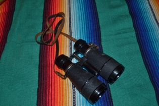
First and foremost, after my backpack of course, are my wallet and diabetic supplies. As a T1Diabetic, it’s kind of necessary to have those!

DSC_2149.JPG

Then there are my FitKicks. I did a post going into more detail here, but these are a great shoe that double as both a water shoe and an active shoe. I usually wear my sneakers or boots whenever we go someplace and bring these along if I’m going in the water. Where we visit the river so much, these are a great shoe that help to grip the slippery rocks. I love having them and highly suggest getting your own pair! They come in various patterns and sizes for men, women and children!
Sunscreen and bug spray are essential. I don’t really have a favorite bug spray, but Cutter seems to work best, especially in the woods. Sun Bum is my favorite sunscreen mostly due to the fact that it’s one of the only ones that I don’t have some sort of skin reaction to. It almost smells AMAAAAAAAAAAAAAAAAAAZING! Coconut-y goodness. That is all.
Some small accessories I carry with me are my waterproof phone case and two different flashlights. The phone case is from Wish.com and it works really well!! I was quite surprised, honestly. If you’re looking to get your own, make sure you get one with the locking top and not the snaps. This one in particular also has a removable neck strap which is a smooth satin ribbon. All in all, I’m a fan.
The pink light in that same picture is also from Wish. It’s really one of those selfie lights that you can charge in a USB port. It doesn’t really shine far, but for the minimal amount of night hiking I do, it’ll work.
I have no idea where the other flashlight came from, but my mom got it for me ages ago. It’s a little LED keychain light that shines much farther than the other, so I keep it with me. There’s nothing I really need either of the flashlights for; they’re really both more for emergency’s sake.

DSC_2156.JPG

Binoculars might seem passe, but they come in handy sometimes. I climbed Bauneg Beg in North Berwick, ME, the other day, and these helped to see Mt. Washington even closer than already seen by the naked eye. I was pretty pleased!

DSC_2158.JPG

SNACKS! Again, I’m diabetic, so these are mostly for emergency’s sake. We usually pack lunch with us anyway, so these aren’t normally necessary but if you know diabetic life, these are necessary and smart to have.
My waterfall book usually comes with me. This site was originally going to be specifically for waterfalls, but we go a lot more places than just waterfalls now, so it became nature. Anyways, that’s beside the point. These are for the waterfalls we visit! I have names and little reviews for each one, organized by state and then the amount of time it takes to get there from home. And of course, to go along with that, pens…

DSC_2155.JPG

I usually bring a book with me. Even if I don’t get to reading it, I like having it if we plan to sit and stay somewhere for a little while. I don’t do well just sitting and relaxing, unfortunately.

DSC_2160

An umbrella because as much as I love the rain, I’m not the biggest fan of walking in it…

DSC_2162My favorite water bottle, of course.

DSC_2166Hair accessories; a couple barrettes, a couple hair elastics and my bandana. These all come in handy now that my hair has grown out!
DSC_2161
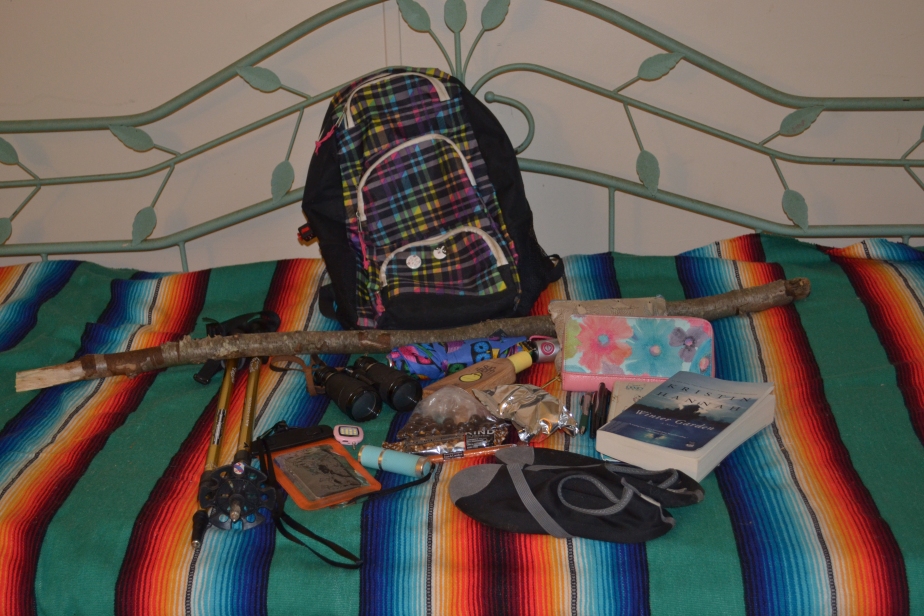
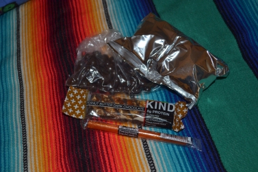
Walking sticks! Obviously, these don’t fit in my backpack, but one of the two is usually with me when hiking.
DSC_2167Last but not least, one of my eleven pairs of sunglasses comes with me. Protecting your eyes is important, y’all!

Well, I hope you’ve all enjoyed this post! What do you take on your treks? Is there anything you thing I should add to my pack? Comment on this post and let me know!

Have fun out there and be safe!

Beede Falls – Sandwich, NH

Overall Rating: 3/5
Swim Rating: 3/5
Hiking Distance/Time: .25mi / 5min
Hiking Difficulty: Easy
Fee: None

About half an hour from NH-16, tucked away in Sandwich Notch Park sits a neat place called Beede Falls. It’s not just another waterfall in the White Mountains; there’s a bit more to it than that! Not only will you find a main waterfall here flowing into a refreshing wading pool, you’ll also find a lower falls that doubles as a natural water slide (several for that matter!) Each tier is short enough, each along with a pool shallow enough to slide down into! The pool at the upper falls is shallow enough (only about knee/calf deep while regular flow) to stand under and behind the falls.

The water here, at least the few times we’ve been, is very chilling. However, I suspect this is due to the fact that there was no sun shining when we visited. It’s a wide enough open area for the sun to hit, so I can only imagine that this would be quite different on a warm and sunny day. Like I previously stated, it’s really only deep enough to wade in, however, I’ve seen astounding pictures when there’s is high water flow and it looks like you could really go for a deep swim! PLEASE, I BEG YOU, if you decide to make that crazy choice, be safe, be careful…. really just don’t be stupid. If you’re not a strong swimmer or the current looks intense, stay away! No thrill is worth your life.

Along with the falls, there’s a couple other things to check out at and around the area. There’s Cow Cave, for one. The story goes that a cow wandered off from a long ago nearby farm. It went missing for a good chunk of the winter and was later found hiding in the cave near the falls. I’m going to have to take another gander, but all the references I’m finding say the cave is the one just under the waterfall. However, I remember seeing a sign after the footbridge, just beyond the falls, that pointed towards the Mead Base Trail. If you know where the cave actually is, please inform me!
Ah, that’s another trail to take! The Mead Base Trail will lead you on a moderate hike back to the Mead Explorer Base Camp. If you decide to take this route, after arriving at Base Camp, the hike is about a half an hour back to the parking lot at the falls.
One last place to stop as you’re making your way back from Sandwich Notch Rd, is an overlook on Diamond Ledge Rd. There’s enough room on the east side of the road to pull over and take in the view of (I believe) Dinsmore Pond. It’s a breath taking view, as you can see from a couple of the pictures above, especially at sunset.

To find Beede Falls, take 109 or 113 to Diamond Ledge Rd. Instead of going straight to the Base Camp, take a left at Sandwich Notch Rd. Follow the road for about .9mi; the parking lot will be on your right.

Have fun and be safe!!

Diana’s Baths – Bartlett, NH

Overall Rating: 5/5
Swim Rating: 3/5
Hiking Distance/Time: .6mi / 25min
Hiking Difficulty: Easy
Fee: $3/car
Restrooms Available (Year Round) // Partially Handicap Accessible

If you visit Cathedral Ledge and Echo Lake in Bartlett, you should most definitely take a short trip up the road and visit Diana’s Baths! An easy walk through the woods will lead you to an astounding waterfall with many tiers. It’s beautiful in summer, in autumn, in winter – pretty much year round!

If you’ve ever wondered where the name comes from, here’s a bit about the name origin taken from Wikipedia:
These curious circular stone cavities on Lucy Brook originally were known as the Home of the Water Fairies; tradition says evil water sprites inhabited the ledges, tormenting the Sokokis Indians until a mountain god answered the Indians’ prayers and swept the sprites away in a flood. But sometime before 1859 a Miss Hubbard of Boston, a guest at the old Mount Washington House in North Conway, rechristened them Diana’s Baths, presumably to evoke images of the Roman nature goddess. The pools are also called Lucy’s Baths.

Diana’s Baths is a wonderful swimming hole in summer – it’s also extremely popular, so get there as early as you can!! There’s little wading pools all along the way, below each tier’s fall. I’ve heard that all the way at the top, there’s a pothole that you can swim in, but I have yet to see it. Hopefully this summer, though!

The walk is very simple and easy on the body. It’s also one of the best ones to go on with small children. It isn’t paved, but the walkway doesn’t have too many rocks or branches, so the trail, for the most part, is handicap accessible up to the lower falls. After that, it’s a bit tricky unless you have an ATV type wheelchair.

To find Diana’s Baths, take West Side Road into Bartlett. It will be on the east side of the road, but really, you can just follow the millions of signs you will surely see!!

Have fun and be safe!!

Albany Covered Bridge – Albany, NH

Overall Rating: 3/5
Swim Rating: 3/5
Hike Distance/Time: less than .1mi/less than 5min
Hike Difficulty: Easy
Fee: $3/car
Handicap Accessible // Restrooms Available
Covered Bridge #49
More information on the bridge structure and history can be found here.


Covered bridges are one of the biggest attractions in New Hampshire, whether you’re a local or a tourist. Some have waterfalls just below them, some are old railroad bridges/trusses, some are now closed to actual traffic but left roadside just for viewing and historical purposes, and most of them span the width of some sort of waterway. Albany Covered Bridge spans the width of the Swift River and connects NH Route 112 and Dugway/Passaconaway Roads.

You could stop at just taking pictures in front of and from the bridge in the fall (the most popular time for visitors), but in other seasons, mostly summer, there’s lots of other stuff to do as well. The following are just a few:

  • To the left and right, both before and after the bridge, there are rock paths down to the river. You can sit on the large boulders here and enjoy the coolness of the water and a picturesque view of the bridge.
  • If you follow the bridge and head to the right after crossing, less than .1mi from the bridge, you’ll find the Boulder Loop Trailhead. From my findings online, the views are gorgeous from the top, but I have yet to climb the trail, so I can’t give you much more than that.
  • About .9mi away from the bridge there’s Big Brook which feeds into the Swift River. Just before the brook is a driveway big enough for two cars (please be courteous; it’s not a place visited often, but it’s still nice to leave a spot if someone comes along and is interested). There are tiny little waterfalls created here by the boulders which sit in the brook. It’s nice, cool and relaxing to sit here and enjoy the water. Just a couple warnings: it’s super cold at the brook; the sun doesn’t really hit it because of such dense tree cover, which can be very shocking to the system if you’re not expecting it. Also, BRING BUG SPRAY. We threw some on the day we went, which helped a bit, but we noticed bugs flying all around us. Not sure it’s really a place you want to stop without spray.

There’s a few more things to do off of Passaconaway Rd, but that’s it for what’s close by the bridge. It’s a truly lovely spot with more to it than just a bridge.

The water is not extremely deep here, but the current is strong so please swim at your own risk. If bringing small children, I highly suggest taking them to the Dugway/Passaconaway Rd side of the bridge and heading to the right. There’s a little bench here and just below is a small sand area. The rocks can be a bit slippery even when dry, so the safest bet would be to head here.

Finding Albany Covered Bridge is pretty simple. If you’re heading west, it’ll be 6 miles from Rt 16. If you’re heading east, it’ll be 29.1mi from Loon Mountain Resort (since I can’t think of anything else over that side of 112… sorry guys…)

Have fun and be safe!!


Rocky Gorge – Albany, NH

Overall Rating: 4/5
SWIMMING NOT ALLOWED
Hike Difficulty: Easy
Hike Distance: .2 mi
Fee: $3 / car, but you can buy one pass and use it at other White Mountain Park locations
Handicap Accessible // Restrooms Available

In the middle of the eastern side of the Kancamagus Highway sits a lovely gorge that shouldn’t be ignored. And while there’s a bridge to walk across where you can see the gorge head on, you can also climb along the rock ledges to get different views and angles of the gorge. In fact, that’s become one of my favorite things to do here, especially in autumn. I’ll bring some crocheting or knitting, sit with my Dunks iced and enjoy the sounds of the rushing water (okay, and, I must admit, many tourists).  There are also picnic tables here as well, so bring a bag lunch to enjoy!

Autumn is probably not the best time to visit if you’re not a fan of crowds, but it is definitely the most beautiful time to see it. The seasonal colors envelop the area perfectly and make for some fantastic photographs. Ice and snow in the winter also makes for lovely photos, but we suggest going early in the season as the area is not plowed out, for parking or walking.

There is absolutely no swimming at the gorge and this is well posted about and strongly enforced.  Just like many other gorges in the region, the current is extremely powerful and dangerous. There’s far too much chance here to bother taking the risk, so please, stay out of the waters here. There are many other spots along this route where you can enjoy swimming.

As of Mar. 2017, there’s currently a daily pass 3$/car fee; you can stop at one scenic area, pick up a pass and use it at any other area where a pass is needed for that whole day. However, there has been a proposal to raise this fee. If the proposal is passed, the fee goes up to 5$/car in spring 2017. As soon as I find confirmation on this fee, I will update the page.

To find Rocky Gorge, take Rt 112 (Kancamagus Highway) to Albany. If heading west, it’ll be on your right, 2.1 mi after Lower Falls. If heading east, it’ll be on your left, 1.6 mi after the Champney Falls Trailhead.

Have fun and be safe!


Willand Pond – Dover/Somersworth, NH

Overall Rating: 5/5 stars
Hike Distance/Time: Main Trail is about 1 mile/45 mins
Extensions are about .75 mi total / total time unknown
Hike Difficulty: Easy
Fee: None

This is one of my favorite natural spots, for two reasons. The first is that it’s literally in my backyard (I’m a little biased on ease of access, so sue me!) and second, because it’s one of the most beautiful natural areas in the town(s). It’s well worth a walk through year round.

Willand Pond is 64 acres in size and sits in both Somersworth and Dover, NH. The trail around the pond is about a mile long, and there are great little spots to stop along the way. You’ll find a bench at the half mile mark to sit and take in the view. You’ll find a picnic area along the way to have lunch and take in the view. You’ll find endurance course equipment along the main path for exercising. Near the Somersworth entrance, there sits an old bandstand structure. All in all, it’s a pretty neat place to enjoy. As you can see from the photos above, there’s a lot of wildlife to be found here as well. There are usually geese, ducks, herons, turtle, and frogs to be found in the vicinity.

This place is amazing and I can’t say much more than that about it. To find the Dover entrance, follow Rt 108; the entrance is across from the Strafford Farms Restaurant. To find the Somersworth entrance, take Rt 108 to High St and take a left at the traffic light near Market Basket. Follow the road straight back and you’ll find the parking lot.

Have fun and be safe!


Profile Falls – Bristol, NH

Overall Rating: 4/5
Swim Rating: unsure at this time; other sources say swimming is possible but there is an odd odor that comes from the water.
Hike Time: from parking lot: about 5 mins (there are other paths, which will be added if we visit again in the future)
Hike Difficulty: Easy
Hike Distance: .5 mi
Fee: None
(photos courtesy of Jim Blackwood, otherwise known as my dad)  

Just 8.1 miles from Newfound Lake in Bristol, NH, on a tributary of the Pemigewasset River called Smith River, sits Profile Falls. This is a large block type waterfall which leads from a singular cascade at the top into five mini breaks. The park in which the falls sits is equipped  with picnic tables, grills and a few different paths to the falls and  is part of a park run by US Army Corp of Engineers.

There’s a parking lot here that holds about 10-12 cars with public restrooms across the street (although, these seem like they’re only set up during the summer as when we visited in October, nothing was sitting on the concrete slab that was near the restrooms sign). Just after the bridge on the road is another parking lot that has parking for 4-5 cars. This is a pretty nice set up for a fun summer visit! It’s absolutely lovely during the fall foliage, as well.

The signs around the parking area direct you to a trail with signs along the way labelled as ‘Profile Falls’, which sounds pretty easy, right? Well, not to say that it isn’t, but the trail that you’re initial led on is VERY steep and it’s a little daunting to actually take this trail. I’m pretty sure both my dad and I didn’t even make it to walking down this trail; we sat and slid. (Good times!, she said sarcastically.)
If you take the trail from the parking area, you can walk along the river edge straight to the falls. However, when we visited, there were some questionable orange arrows and a sign that said ‘stay away from ledge; very steep/very dangerous’ (or something along those lines) on the original trail. We assumed that the orange arrows would lead to an easier & safe path, but we were unable to find any further signs on the supposed trail, so we went back to the original trail, disobeying the signs. I wouldn’t recommend this method as, like I said before, it’s steep and not fun to slide down. If you go across the bridge, there’s another picnic area and beyond that is a snowmobile trail which you can take for easier access to the falls. We haven’t taken this path yet, but per other sources it sounds easy; we’ll find out next time.

As far as swimming goes, it is possible as there is a large pool below the falls but per other sources, there is said to be a strange odor coming from the water. I mean, it is a little hard to tell in October when you don’t have a wet suit or feel like getting hypothermia, so I can’t really speak from experience. In other words, swim at your own judgement and risk.

To find this waterfall, head North or South on 3A in Bristol and turn onto Mt. Hill Rd. Head down Mt. Hill Rd and you’ll be there in no time!

Have fun and be safe!